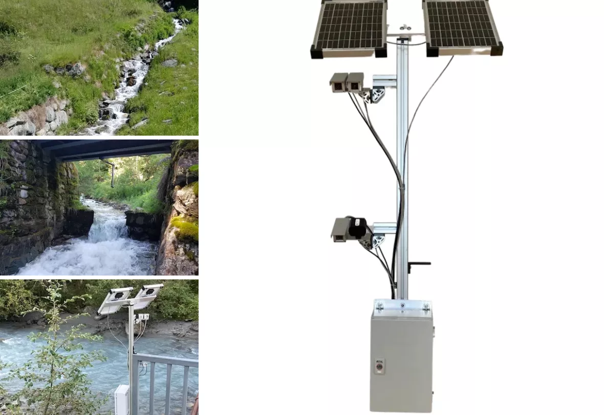
In an innovative collaboration, Neuchâtel’s CSEM and Precidata have pioneered a contactless system for real-time waterway monitoring.
Originally conceived during the 2021 BlueArk Challenge, a project initiative by Châble-based center BlueArk, this lightweight, mobile system offers communities a sustainable solution. With its three cameras, the system provides a comprehensive view of water flow, 24/7, year-round. Two solar panels ensure self-sufficiency, while a wireless connection transmits vital data to a server, keeping communities informed.
This ingenious system stands out in a market saturated with monitoring solutions that often impinge on natural habitats. Existing solutions, like satellite imaging, offer limited temporal and spatial sampling, and are unable to generate real-time alerts. Industrial solutions, though effective, may adversely affect the environment, and imaging systems for larger waterways are costly and bulky.
Precidata‘s solution, supported by the canton of Neuchâtel, has been meticulously crafted to address these challenges. Its multiple cameras, including energy-efficient infrared and color models, record water flow from dual perspectives, allowing for 3D image reconstruction. When unusual events like heavy rainfalls or flash floods occur, the system promptly sends out warnings. It can also notify users about high or low water levels or even drought scenarios.
The collaborative pursuit of sustainable waterway monitoring
This innovation has been powered by the combined expertise of CSEM and Precidata. CSEM, leveraging its proficiency in AI and Computer Vision, developed algorithms for segmentation, 3D mapping, and flow rate calculation. In parallel, Precidata undertook the seamless integration of the various components. The end product is a field-ready solution that offers accurate flow rate measurements, enabling users to compare current data with past records.
Cédric Berger, CEO of Precidata, highlights the significance of this development: “Our system provides the Swiss Confederation, cantons, municipalities, and conservationists a crucial tool for informed decision-making, modeling floods, and droughts. It empowers them to strategize optimal water usage and prevent potential damages.” After successful field tests in the cantons of Neuchâtel and Valais, this promising solution awaits presentation to prospective users. Depending on feedback, it may undergo further enhancements.


